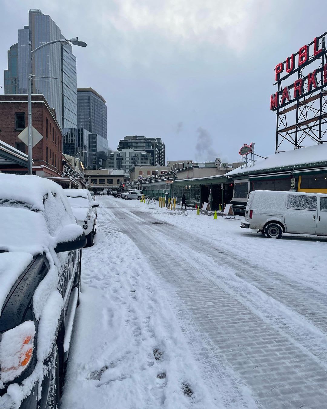
Snow came too late in Los Angeles County to count as a white Christmas, but it fell in time in Seattle — and it continued to fall until it covered the ground around the landmark Pike Place Market on Sunday.
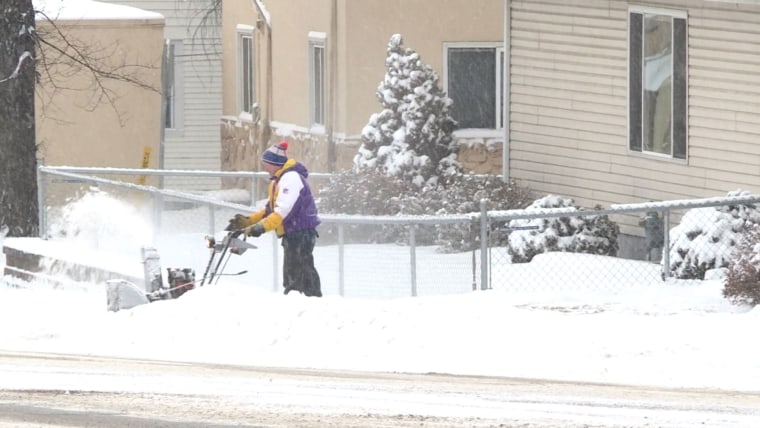
The powder fell as a second cold, stormy front walloped the West Coast during the holiday weekend, triggering winter storm warnings from Seattle to San Diego, which continued as a new wave of precipitation was expected Monday and Tuesday.
A heat wave continued to bake the Southern Plains, where temperatures were as high as 25 degrees above normal and were expected to stay there through at least Monday, federal forecasters said. Temperatures in the 80s were recorded Sunday in Wichita Falls, Texas, and Frederick, Oklahoma.
The big white Christmas news came for Seattle late Saturday in a region unaccustomed to powder on Dec. 25. It continued overnight, and about 5 inches or more of snow accumulated in the region, with some areas recording much more.
Dec. 26, 202101:36
In the Sierra Nevada Mountains of California, Interstate 80 in the Donner Summit area was closed for a third day, and snow conditions were so perilous that the National Weather Service office in Reno, Nevada, said, “If you have the luxury of staying home and not having to drive today, take advantage.”
As much as 3 feet of snow fell in the area overnight, and 2 more could fall by the end of the day, federal forecasters said.
In Los Angeles County, as much as 10 inches of snow fell at Mount Baldy, with even Mount Wilson, a peak seen far and wide in the country’s second-largest city, registering 2 inches.
With another pulse of precipitation possible Monday night into Tuesday, forecasters said the snow level could drop to 2,500 feet, meaning even lower Los Angeles Basin foothills could get some powder.
Snow fell to the south, at Santiago Peak in Orange County and Palomar Mountain in San Diego County, which had both recorded about an inch and a third of powder by Sunday morning, according to the National Weather Service.
Government forecasters said in a forecast discussion that “a broad upper level” trough of low pressure with “cyclonic,” or counterclockwise, flow would continue to wallop the West Coast with storms through at least Tuesday.
Two more systems producing rain and snow were expected.
Meanwhile, the unseasonably high temperatures in the Southern Plains could spread to the South this week, forecasters said.
A “mixing of unusually warm temperatures, low humidity levels, and windy conditions” prompted the U.S. Storm Prediction Center to issue a critical fire weather risk assessment for parts of the central and southern High Plains, including the Texas and Oklahoma panhandles, the weather service said in a forecast discussion.
Source: | This article originally belongs to Nbcnews.com