
SOME Google Maps users have just realized that they can explore inside reactor buildings at the Chernobyl Nuclear Power Plant.
A nuclear reactor in the Chernobyl Nuclear Power Plant exploded during a safety test in 1986.

6

6

6
The plant is still radioactive to this day and scientists are carefully monitoring it and the surrounding area in Ukraine.
Around 116,000 people were evacuated from the surrounding area in 1986 and there is now a 30-kilometer exclusion zone where it is illegal to live.
Tourists who visit Ukraine can book a short tour of Chernobyl because a short time spent in the radiation is not thought to be harmful.
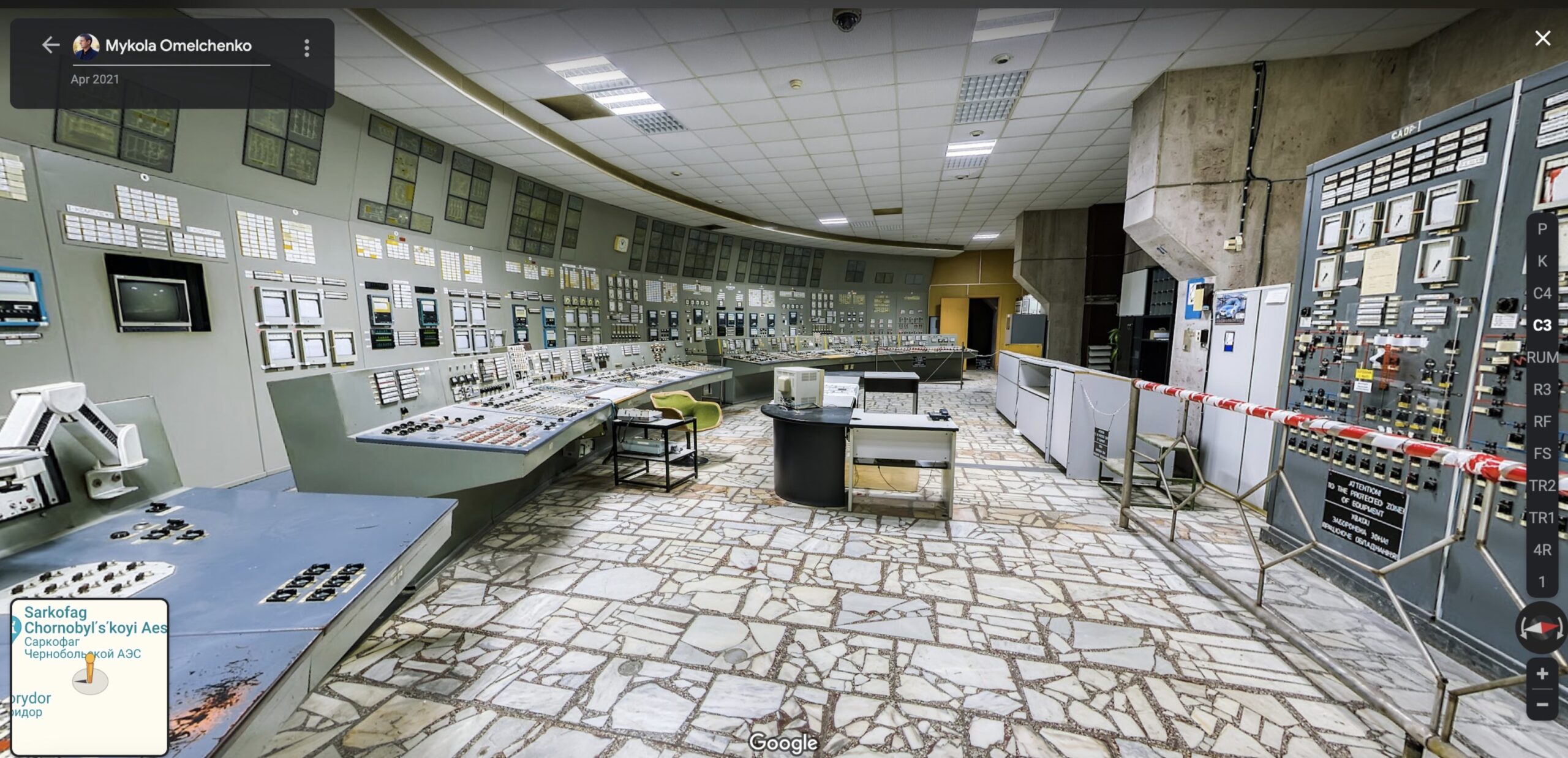
You can also visit the site via Google Maps and even take a look inside some of the power plant’s buildings.
Some Google Maps fans have posted screenshots from the site on the popular Reddit thread r/googlemapsshenanigans.
User joshkukosh22 recently posted a screen-recorded video showing how you can zoom into the power plant location and look inside buildings.
They wrote: “Looking at the street view at the Chernobyl power plant took me inside with a room full of scientists.”
The video shows how you can zoom in on one of the reactors at the site.
Most read in News Tech
Another person claimed to be able to see inside the sarcophagus that currently covers the nuclear reactor that exploded.
However, people disputed the location in the comments due to concerns over safety and access.
One Reddit user commented: “There’s tens of shots in the 3rd reactor room, however none in the 4th as it has been completely blown up.
“The third one is safe, as it was operated into the 90’s.”
Another person explained: “Official street view is done by Google, but most non-road images are ‘photospheres’ that are posted by the public.
“Both can be accessed on google maps and google earth.”

6

6

6