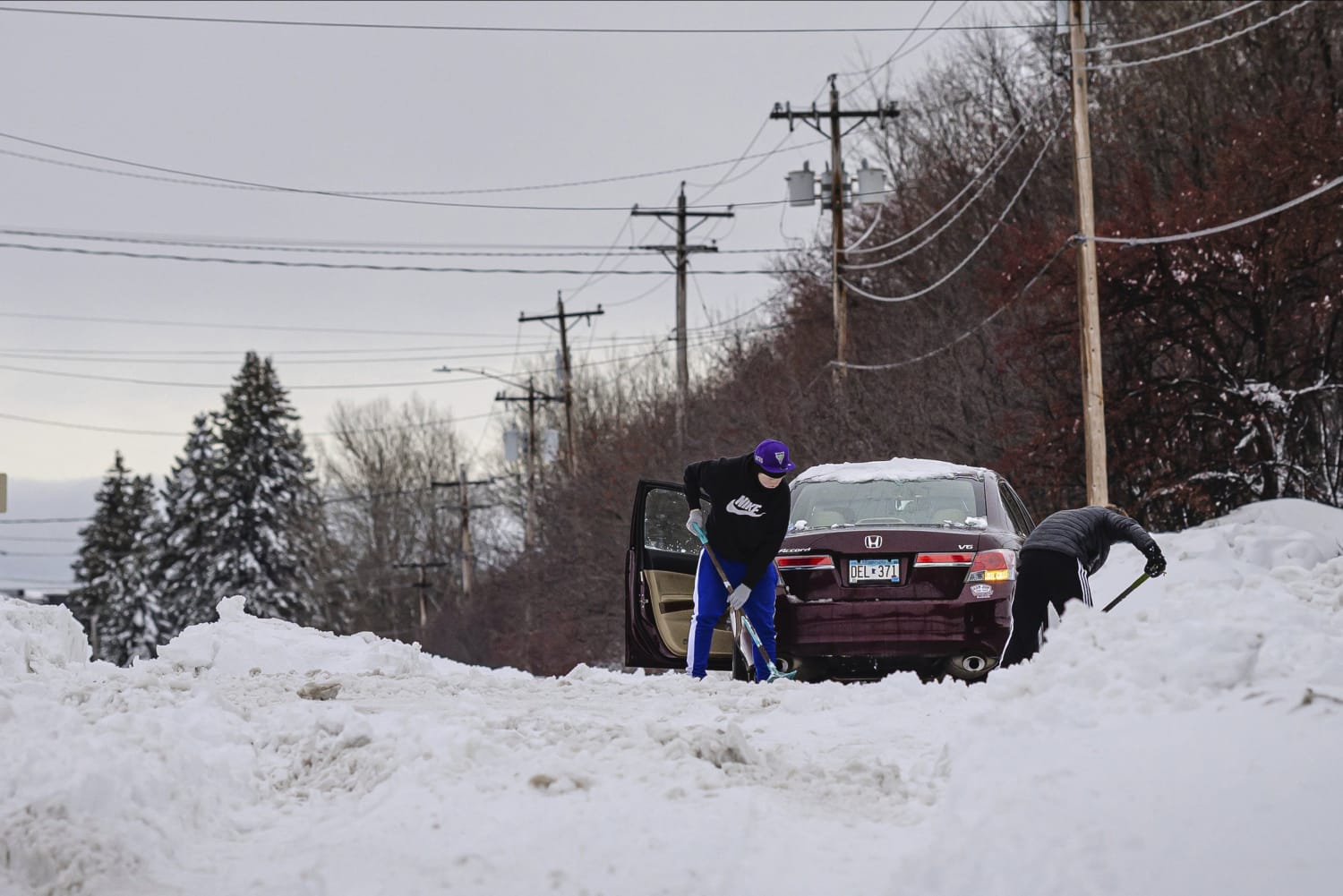
As the storm pulls away to the north and east, cold winds swinging around from the west and northwest out of Canada will ride over the Great Lakes and lead to heavy snow downwind of lakes Erie and Ontario through the weekend.
While this lake effect snow setup won’t produce nearly as high of snow totals as the historic November event, Buffalo could still pick up 15 to 22 inches of new snow through the weekend. They are already running over 18 inches above average for the season.
While the Northeast and New England contend with the winter storm on Friday, parts of the Plains entered their third day in a row of blizzard conditions.
Blizzard Warnings were extended to last into Friday evening across parts of eastern Montana, the Dakotas and northern Nebraska where additional snow amounts of 1 to 3 inches combined with strong winds gusting to 50 mph will lead to whiteout conditions and dangerous travel.
Coined “Blizzard Alley,” these areas are no stranger to blowing snow and high winds but even this blizzard packed an extra powerful punch. Over the course of several days, an astonishing 3 to 4 feet of snow buried these regions. Bismarck, North Dakota, is now off to its snowiest start to any season on record.
The snow is forecast to end and winds subside by Friday night.
Dec. 16, 202201:31
This was the same system that produced a deadly three-day tornado outbreak on its southern side. As of Friday morning, more than 30 tornadoes had already been confirmed across seven southern states.
Behind the snow, the cold takes control.
Bitterly cold arctic air began making its way south on Friday, with the coldest temperatures of the season expected this weekend across the northern Plains and Upper Midwest.
While the cold temperatures this weekend won’t be record setting for the Plains and Midwest, wind chills in the single digits to below zero will be dangerously cold.
The cold won’t stop there. This cold outbreak will last into next week and expand south and east with time.
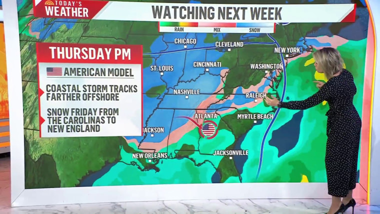
Looking at the week leading up to Christmas
The week leading up to Christmas could have two big weather stories.
The first could be that some areas could experience their coldest Christmas in years. If the arctic outbreak makes it as far south and east as the Gulf Coast, Southeast and Mid-Atlantic, there will likely be the talk of the coldest Christmas Eve and Day in years for these regions.
The second story, which has the lower confidence but is likely to garner the bigger headlines, is a potential winter storm for the East.
There is exceptionally high uncertainty in this forecast, but meteorologists cautioned that major forecast models have a signal for a potential snowstorm somewhere in the East at the end of next week.

Source: | This article originally belongs to Nbcnews.com