CONSPIRACY theorists have used Google Earth to fuel a laughable argument that the Earth is not a globe – but is, instead, flat.
So-called Flat Earthers say the reason Antarctica is blurry on Google Earth is because it’s hiding a ‘mystery’ – but there’s a simple explanation.

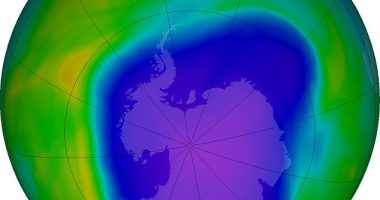
1
A Reddit post by a user named after a 9/11 conspiracy, asked: “Why are areas of Antarctica so patchy on Google Earth?”
Modern day Flat Earthers were quick to jump on the post to spin tales about their belief – which has been debunked by scientists across the globe.
They say it is ‘proof’ that Antarctica is hiding a giant ice wall that stops people from falling off the edge of the Earth – or discovering that the planet is flat.
Time and time again, scientists have proven this theory false.


We actually know more about the curvature of the Earth than nearly every other topic in physical science.
“My counter argument to the people who says ‘there’s nothing there to capture [in Antarctica]’ is if that’s the case why are we also imaging mountain ranges and desert fields out in the middle of nowhere with near perfect imagery?,” one Redditor commented on the post.
Another replied: “Because that’s how orbits work. The earth is really big and most of what a satellite is going to pass over is uninhabited.”
This is true. There are very few polar orbiting satellites.
Most read in Tech
There are similar patchy zones in the North Pole as well.
This is because navigation and imaging satellites are focused on where there are people to make use of them – not unpopulated areas like Antarctica.
Google Earth uses satellite imagery from a raft of different satellites.
But processing satellite imagery is expensive and time consuming, and since nobody lives in most areas of Antarctica, there is little incentive for Google Earth to spend time and money on improving their mapping of it.
What Google Earth fans will see when they go to Antarctica via their computer is a mixture of resolutions and satellites, and sometimes images of poor quality.
One conspiracy-doubting Redditor wrote: “How often do you think satellites and aircraft go by this region?
“If someone wanted to hide something here, why not just doctor photos?
“In Antarctica there’s virtually no reason to fly anywhere inland. So you have to wait for the occasional satellite.”
Best Phone and Gadget tips and hacks

Looking for tips and hacks for your phone? Want to find those secret features within social media apps? We have you covered…
We pay for your stories! Do you have a story for The Sun Online Tech & Science team? Email us at [email protected]