
The first significant lake effect snow event of the season is underway across parts of the Great Lakes and interior Northeast, with heavy snow expected to continue through Wednesday morning.

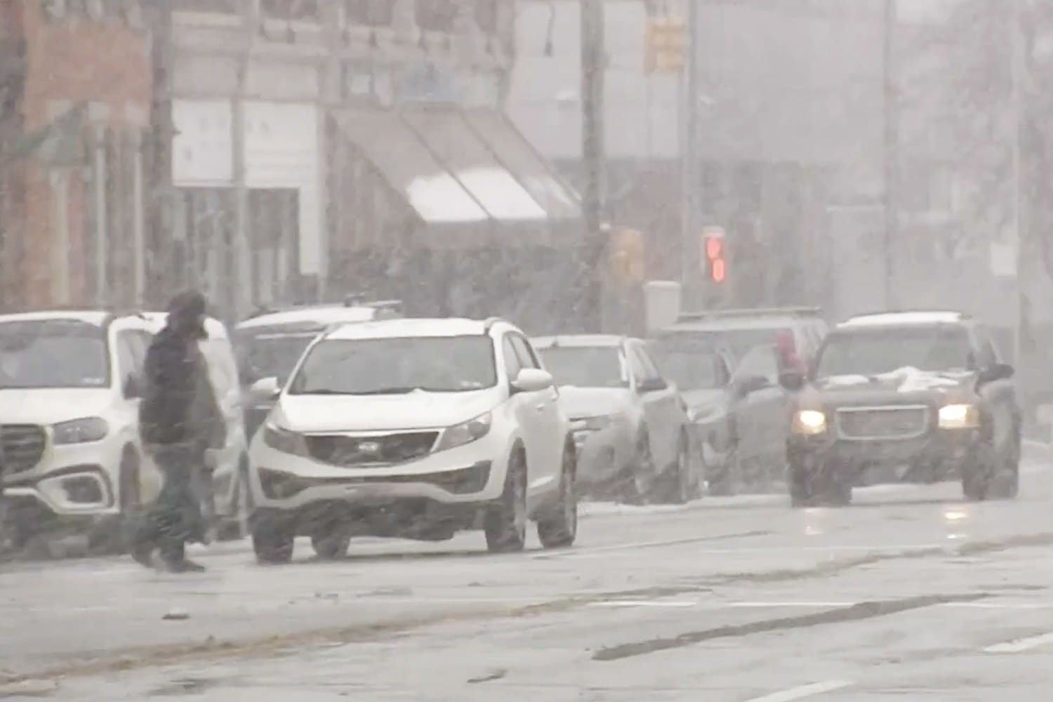
Of particular concern will be for anyone traveling across portions of New York, Pennsylvania, Ohio and Maryland where snow squalls could cause a sudden drop in visibility and whiteout conditions on the roads.
I-90 across upstate New York was one of the areas forecasters were watching closely Tuesday morning, as a subtle wind shift began pushing a strong snow band over the highly-traveled corridor. This included the Syracuse area, which was expected to pick up several inches of snow through the evening hours.
The lake effect snow will continue through Wednesday morning, with an additional 8 to 16 inches of snow possible in the typical snow belt areas downwind of lakes Erie and Ontario. Storm totals by the time the snow ends could be in the 30-40 inch range, especially for the Tug Hill Plateau area of upstate New York.
Due to strong winds associated with the lake effect snow, some flurries, or mood snow, could make it into the Washington, D.C., Philadelphia and New York City metro areas.
No accumulation is expected for the big cities, so should any flakes fly, they will be more conversational in nature.
Lake effect snow occurs when a cold air mass flows overtop of the still relatively warm and ice-free Great Lakes. The temperature difference creates clouds and eventually snow that falls downwind of the lakes.
The cold air mass responsible for producing the snow is the coldest of the season so far. On Tuesday morning, single digit temperatures with wind chills below zero were recorded across parts of the Upper Midwest, including Minneapolis. Chicago woke up to wind chill values in the single digits, and New Yorkers started their days with wind chills in the 20s.
The cold isn’t just confined to the Midwest and Northeast, however, with a chilly Tuesday expected for all areas east of the Mississippi, where high temperatures are expected to be 10-20 degrees below average.
Highs Tuesday will struggle to reach 40 for the big cities along the I-95 corridor, and remain in the 50s for cities in the Southeast like Atlanta, Tallahassee and New Orleans.
This first cold blast of winter will continue for the next two days, then will moderate by the end of the week.
Source: | This article originally belongs to Nbcnews.com