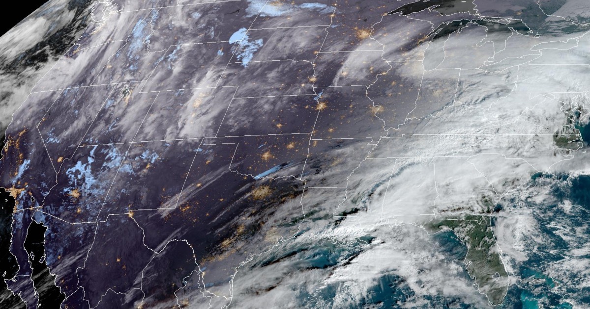
A wet weekend is on tap for both the East and West coasts and the Hawaiian islands.
While the rain heading for the East Coast is not expected to spark widespread or significant flooding, it’s a different story for the Pacific Northwest and Hawaii where several inches of rain could cause urban flash flooding, runoff from snowmelt could cause streams and rivers to run high and landslides are a real risk.
On Friday morning, strong thunderstorms rolled along the Gulf Coast, packing gusty winds, heavy rain and frequent lightning. Through the day, the thunderstorms will move east bringing with them the risk for strong thunderstorms capable of damaging winds and a low risk of a tornado. The areas most at risk include southeastern Louisiana, southern Mississippi, southern Alabama and the western Florida Panhandle. Cities to watch include Mobile and Montgomery in Alabama and Pensacola, Florida.
Another wave of rain will affect the Gulf Coast states again on Saturday. Through Sunday, 1 to 2 inches of rain could fall across this southern tier, with locally higher amounts of up to 5 inches possible.
Farther north, light rain is expected to move from the Midwest and Mid-Atlantic into the Northeast and New England by midday Friday. Rainfall amounts are not expected to be heavy, but instead more of a nuisance. A more soaking rain is forecast to impact these regions on Sunday.
Both rounds of rain for the Mid-Atlantic, Northeast and New England will amount to generally 1 inch of rain or less.
While the East Coast will deal with mainly light to moderate rain through the weekend, a pair of storms is set to affect the Pacific Northwest through the weekend and into early next week.
A Flood Watch was posted for much of Washington and Oregon on Friday morning, which will remain in effect through Tuesday. This long-duration Flood Watch was hoisted ahead of two storms fueled by atmospheric rivers expected to bring wind, rain and mountain snow to Washington, Oregon, Idaho and northern California.
Rainfall amounts of 3 to 7 inches will be possible, with the highest rainfall totals likely over the Cascades, Cascade foothills, and western Columbia River Gorge.
Several feet of snow is also forecast for parts of the Cascades. Snow levels are initially expected to be high, with the greatest snow totals confined to the higher elevations. For this reason, the western facing slopes of the Cascades may be subject to an enhanced risk of flooding due to added snow melt.
The active pattern for the Pacific Northwest will persist into next week, with another round of significant rainfall expected Monday into Monday night with highest rain totals like over the Olympic Peninsula. As the soils get more saturated with each successive storm, the flood threat will increase through time.
Outside of the continental U.S., Hawaii is also dealing with a “Kona storm” that has already dropped double-digit rainfall totals over some parts of the islands, with more to come through Saturday. All islands were under a Flood Watch as of Friday morning.
An area of low pressure over the Pacific Ocean, known as a Kona low for this part of the world, has been feeding copious amounts of tropical moisture toward the island chain, resulting in torrential rainfall.
A Kona low is described by the National Weather Service as a hybrid system between a winter storm and tropical cyclone and is most common during the winter season. Kona lows are notorious for producing flooding rainfall, heavy mountain snow and strong thunderstorms capable of damaging wind gusts.
The heaviest will fall on the southwestern slopes of the mountains, which ordinarily are in the leeward side (or “Kona” side) of typical northeasterly trade winds. These locations are where personal weather stations on Thursday reported 15 to 17 inches of rain in less than 10 hours.
More than 90% of Hawaii is under some sort of drought, but too much too fast is leading to a flash flood risk. Landslides were reported on Thursday, with the risk continuing through Saturday.
As the Kona low moves away, a drier pattern will prevail on Sunday.
Source: | This article originally belongs to Nbcnews.com


