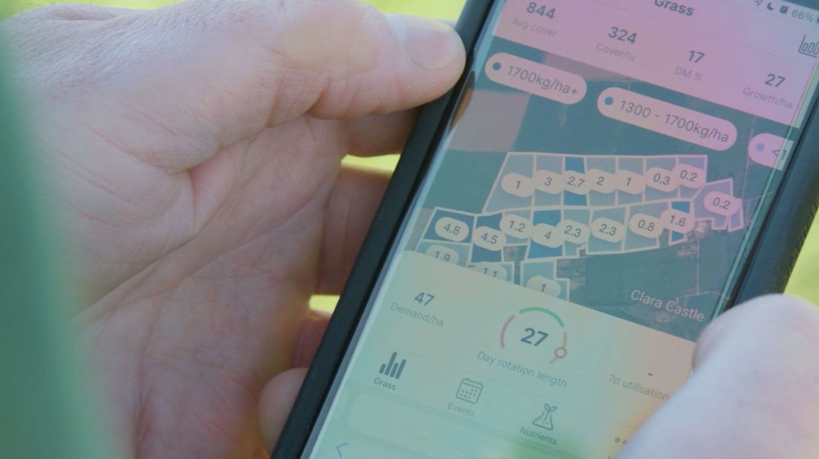

Aspia Space is joining the ranks of companies and space agencies working on remote sensing, tracking the physical attributes of things on the ground by using sensors on satellites. The majority of Earth observation satellites, like NASA’s long-running Landsat program, use sensors for optical images—essentially, photos from space. But at any given time, the majority of the Earth is covered in clouds, as well as smoke and air pollution, which can block those sensors and create major data gaps. Radar has the benefit of piercing through clouds so it can provide a clear picture at any time—even in perpetually cloudy parts of the Irish countryside.
Radar satellite imagery involves sending radio waves and microwaves, bouncing them off the Earth’s surface, and detecting their echos. One can identify landmarks in a radar image, but the images are hard to interpret without expertise. That’s why Aspia uses ClearSky to convert them into optical images. The resolution matters too, so Aspia and others typically use “synthetic aperture radar,” or SAR, which simulates the effect of a longer antenna and generates higher-resolution images.
A few companies in the commercial space industry have adopted SAR in recent years, including California-based Capella Space and Umbra Space, and the Finnish Iceye. While Aspia focuses on analyzing data from space agency orbiters, these companies own their own satellites and sell or license their radar data to others. For example, Capella recently announced an analytics partnership program so that other firms can design their own algorithms using Capella’s radar images, says Adam Thomas, the company’s director of business development.
Comparing high-resolution radar images of the same area to spot precise changes, like distressed versus healthy crops, is “the real superpower for SAR,” says Todd Master, Umbra’s chief operating officer. (His company is particularly interested in a similar application: flood tracking.)
Courtesy Origin Digital
Until a few years ago, SAR data was largely only available to military and intelligence agencies. But now that customers have access to radar data from private companies like Umbra, they will find more potential uses for it, especially involving analytics. “That’s what you’ll see unlocked in the next decade,” Master says.
Aspia is now working to incorporate generative AI into ClearSky in order to make forecasts about future crop growth and droughts. “Essentially, ClearSky is using the same principles as GPT,” Geach says. Just as large language models like ChatGPT and Bard that have absorbed huge amounts of text from the internet can predict a likely series of words, ClearSky will take in satellite imagery of a particular area and predict a series of images to follow. “The model predicts the most likely next sequence: What does tomorrow look like?” he says.