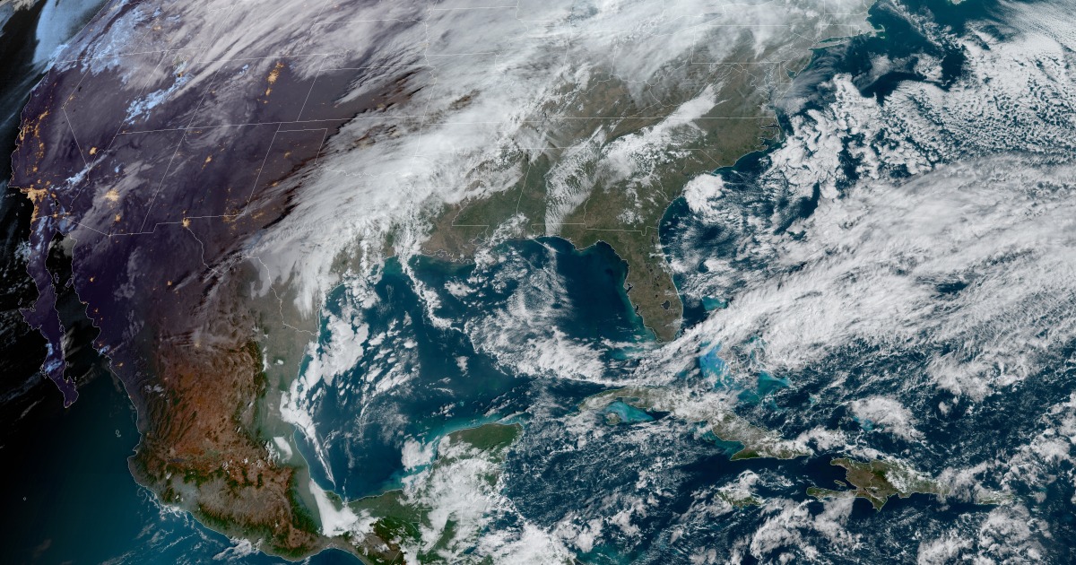
Millions of Americans woke up Wednesday under weather alerts ahead of expected risks for flooding, heavy snow, dangerous ice, fire danger and high winds.
These were all ahead of a massive storm system expected to cross the country through the rest of the week.
On Wednesday, the storm was expected to produce heavy rain from Missouri to Michigan, with severe thunderstorms breaking out late in the evening and during the overnight hours across the southern Plains.
The main risk with the severe thunderstorms Wednesday night into the early hours of Thursday will be large hail followed by isolated tornadoes. Cities at risk include Oklahoma City, Dallas and Wichita Falls.
During the day Wednesday, wind gusts over 40 mph, and as high as 75 mph in isolated spots, combined with low humidity were also anticipated to lead to a high fire danger across parts of New Mexico, western Texas and parts of Oklahoma. Red flag warnings were in effect to provide a head’s up for the potential for rapid fire ignition and spread.
On Thursday, the rain across the Midwest and the Great Lakes was expected to change to ice and snow by midday. Meanwhile, heavy rain would continue for portions of the Tennessee and Ohio valleys.
At the same time, severe thunderstorms charging across the Southeast through the day will impact the major metro areas of Memphis, Nashville, Louisville, Birmingham, Jackson, Little Rock and Shreveport.
The main risk from Thursday’s thunderstorms is expected to be damaging straight line winds. The secondary threat, however, will be a few tornadoes, especially across portions of Mississippi and Alabama.
Thursday night into Friday, the storm system will finally reach the East Coast, where heavy rain will impact the mid-Atlantic and the Northeast, while snow falls over New England. The greatest risk along the Interstate 95 corridor will be strong winds that could down trees and cause power outages.
All rain is forecast to be off the Atlantic coast by around 9 a.m. Friday.
Snowfall amounts from the central Plains to the Great Lakes will be generally 4-8 inches, with locally up to 10-12 inches possible.
Ice accumulations are forecast to be 0.10-0.25 inches for many of these same areas.
As of Wednesday morning, there was still a good deal of uncertainty around forecast snow totals. The ribbon of heaviest snow, where snowfall rates could be up to 2 inches per hour at times, will be in a narrow corridor from Kansas to Michigan. Wichita, Kansas City, Chicago and Detroit are all in or near this forecast axis of heaviest snow, meaning high boom or bust potential when it comes to totals.
Another element adding to the uncertainty in snow totals is precipitation type. With a combination of snow, sleet and freezing rain all possible, whatever precipitation type dominates will impact final snow totals.
The rainfall forecast has higher confidence compared to the snow, with a large area expected to receive 1-3 inches of rain through Friday.
The greatest risk for flooding will be where this heavy rain falls over the healthy snow pack of the Midwest. That could cause river and ice jam flooding, as well as flooded roadways. Flood alerts were in effect from Missouri to northern New England to cover this threat.
City timing:
Denver: Snow begins around 3 p.m. Wednesday and continues until around 3 a.m. Thursday; 4-7 inches of snow expected
Dallas: Showers and thunderstorms begin in the evening Wednesday, and continue until around the morning commute Thursday; the greatest risk for severe storms is between 11 p.m. and 5 a.m. Wednesday into Thursday.
Chicago: A city with one of the most complex forecasts of all, it could experience all precipitation types leading to high uncertainty in snow total forecast. Chicago’s detailed timeline:
*Showers begin Wednesday afternoon and continue until early Thursday. Between 4 a.m.-1 p.m. Thursday is when Chicago can expect a mix of rain, sleet and snow. After the lunch hour and lasting until late evening the dominant precipitation type is expected to be all snow. Winds could gust as high as 40 mph with 2-6 inches of snow expected at this time. Given the uncertainty, this snowfall forecast is still subject to change.
New York: Rain and isolated thunderstorms begin late Thursday and continue until Friday morning. Timing of heaviest rain and wind between 2 a.m.-8 a.m. Friday. Winds could gust as high as 40 mph and rainfall amounts could be 0.5-2 inches.
This crosscountry storm will also be responsible for roller coaster temperatures across the eastern third of the country, with the center of the country experiencing temperatures that will drop anywhere from 20-40 degrees in less than 24 hours.
On Wednesday, temperatures will be mild ahead of the storm, with high temperatures across the Plains and the Midwest 10-20 degrees above average. Thursday, this changes in a big way as cold air surges in and high temperatures will instead be 10-20 degrees below average for these same regions.
Kansas City, for example, is forecast to see a high around 65 degrees Wednesday, compared to a high of 27 degrees Thursday.
The East Coast, however, will see temperatures 10-20 degrees above average Thursday leading to the chance for a few spotty record highs across New England. This includes Boston, which could tie a daily record if it hits 61 degrees. The East will get the cooler temperatures by the weekend.
Source: | This article originally belongs to Nbcnews.com


