

A cross-country storm will bring rain, wind and storm impacts from coast-to-coast this week. When it reaches the East Coast, it could bring the first substantial snow event in two years for some major cities.
With this storm still several days away for the East Coast, there is still a large degree of uncertainty for the timing and track, but the forecast still points to snowflakes returning to parts of the Northeast. How much falls and where will depend on the storm’s path and where the rain/snow dividing line ends up.
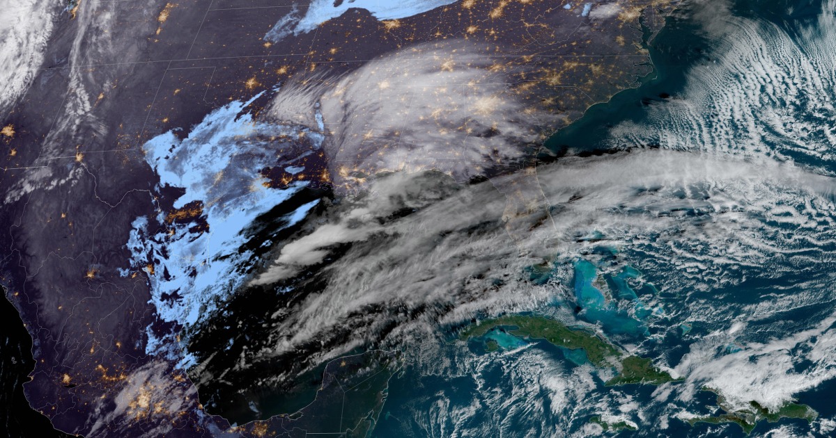
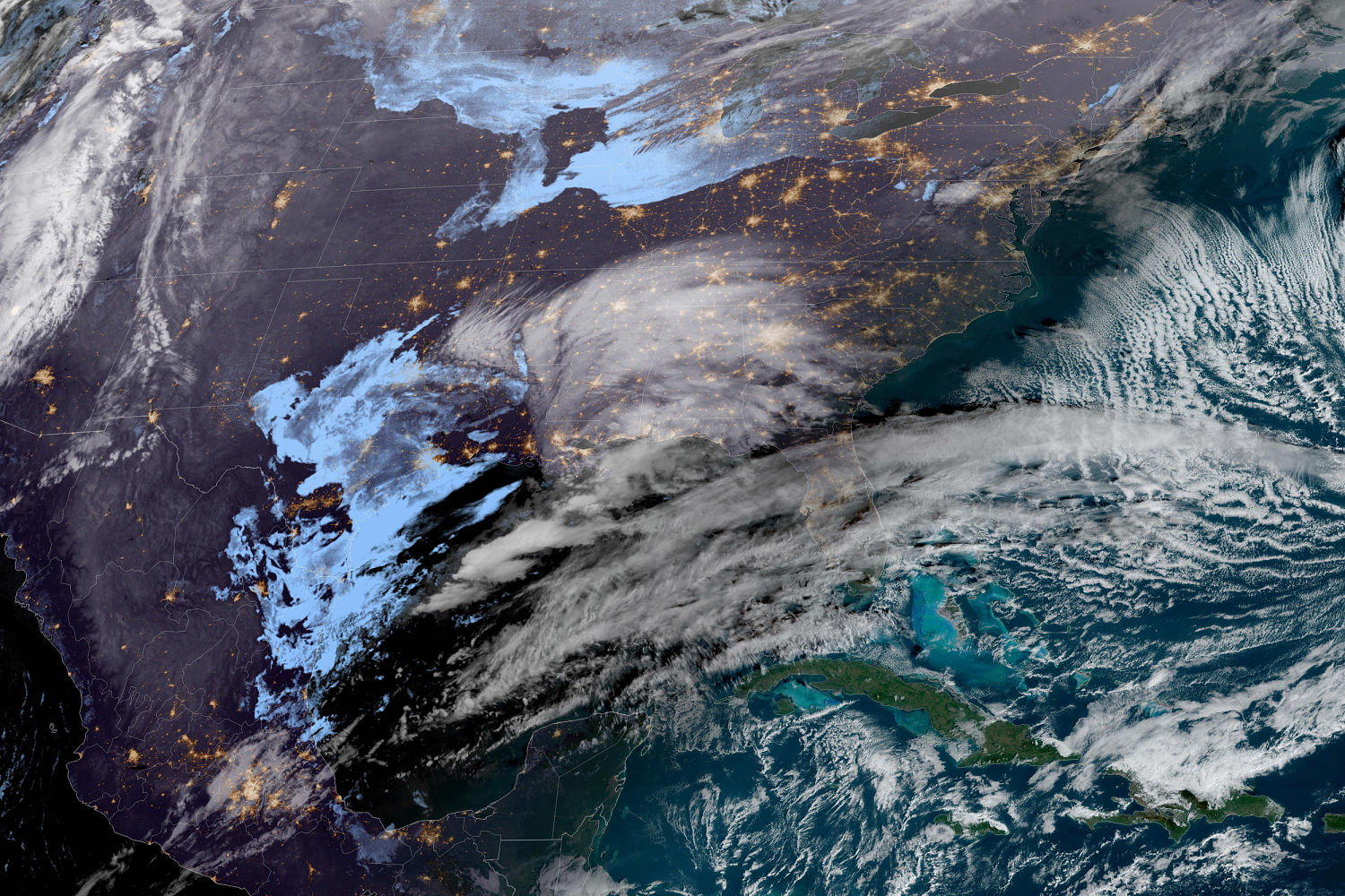
While the East Coast waits for what is shaping up to be an impactful storm, those out west are already feeling the storm’s impacts.
After bringing rain, mountain snow and high surf conditions to the Pacific Coast on Tuesday, the storm system will move inland on Wednesday, producing rain and snow spanning throughout the Great Basin and Southwest. The highest snowfall totals are expected to be across the highest elevations in Nevada, Utah and northern parts of Arizona.
Thursday, the storm will produce heavy snow for the southern Rockies early in the day, before pushing south and east into the Southern Plains by the afternoon. Showers and non-severe thunderstorms will fire up in the evening hours across western Texas, bringing brief downpours and a few rumbles of thunder.
Heading into Friday, this system will strengthen as it dips south in its track. Widespread heavy rain across the Gulf Coast could lead to instances of flooding as this system continues east. There is an isolated chance for strong thunderstorms capable of producing damaging winds, but heavy rain will be the biggest threat to the Gulf Coast states.
Saturday the storm is forecast to turn north, bringing widespread rain across the eastern seaboard while breaking out some inland snow. Currently, the greatest snow chance lies north and west of the Interstate 95 corridor, with a better chance for all snow over parts of Interstates 81, 80 and 78. As a mix of rain, snow and sleet expands across the Mid-Atlantic, Appalachians and into the Northeast throughout the day, travel will become increasingly hazardous.
On Sunday, the storm races northeast, but will continue to produce snow, rain and wind for much of New England. By Sunday night, conditions will likely be clear for D.C. and Philadelphia, while New York City, Hartford, Providence and Portland, Maine, could still experience wind, rain, sleet and snow.
The biggest question mark remains where the rain/snow line will set up. If the system takes a more coastal track, it will pull mild ocean air into coastal cities producing more rain and less snow. This would keep the risk of heavy snow further inland through the Appalachian Mountains and into Maine.
If the center of the storm shifts farther south, taking more of an offshore track, this would bring colder air to the coast, with heavier snow from D.C. to New York.
Due to the storm still being several days out, meteorologists cautioned it is too early to predict exact timing of when the rain or snow might arrive and also provide any exact snowfall totals. However, it is possible to point out areas that are most likely to see light vs. moderate snow.
The I-95 corridor is likely to be on the rain/snow line which could mean a range of a few inches of snow to just wet roadways. For now, cities that could see light snow accumulations include: Washington, D.C., Philadelphia, New York City, Hartford and Providence.
The heaviest snow and higher snow accumulations are most likely to occur north and west of the I-95 corridor across the interior Northeast and toward the higher elevations of the Appalachian Mountains. Cities that could experiences several inches of snow include Harrisburg and Scranton in Pennsylvania; Poughkeepsie, Albany and Binghamton in New York; and Worcester, Massachusetts.
Even if the I-95 cities don’t get multiple inches of snow, they just need 1 inch or more to snap some record-snowless streaks that have been ongoing for two years or more.
The current streaks as they stand for number of consecutive days since 1 inch or more fell in a 24 hour period:
- New York: 689 days; #1 longest
- Philadelphia: 704 days; #1 longest
- Washington, D.C. (Reagan National): 717 days; 2nd longest
- Baltimore: 705 days; #1 longest
- Richmond, Virginia: 717 days; 2nd longest
Source: | This article originally belongs to Nbcnews.com