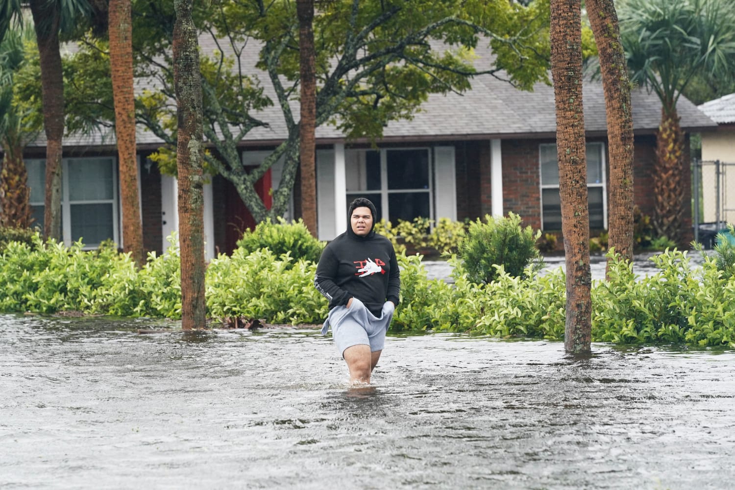
North and South Carolina were on alert Thursday as Ian made its way toward them after cutting a path of destruction through Florida.
The storm, downgraded to a tropical storm after striking Florida’s west coast as a major hurricane Wednesday, is expected to become a hurricane again by Thursday evening, the National Hurricane Center said.
A hurricane warning is in effect for the entire coast of South Carolina. A tropical storm warning extended to a portion of the North Carolina coast.
Rivers in North and South Carolina — South Santee River and Pamlico River — were also issued storm surge watches by the hurricane center, while others, such as the Neuse River and St. Johns River, were given storm surge warnings.
The storm is expected to approach the coast of South Carolina on Friday and move inland across the Carolinas on Friday night and Saturday, rapidly weakening as it moves across land, according to the National Hurricane Center.
In anticipation of the storm, South Carolina Gov. Henry McMaster issued a state of emergency for South Carolina Wednesday. The governors of North Carolina and Georgia did the same.
“If you haven’t yet made plans for every contingency, this afternoon is the time to do so,” McMaster said Thursday. “We can expect to experience a lot of rain throughout the state along with dangerous storm surge in low-lying coastal areas. With the potential for hurricane force winds along our coast, it’s important for South Carolinians to plan now.”
While South Carolina faces the largest threat from the storm, North Carolina and Georgia also could see significant flood events because of the downpour and storm surge created by Ian.
Officials urged residents in those states to remain on alert even though the storm has been downgraded after its catastrophic turn in Florida, though they had not ordered any evacuations.
“Just because it’s no longer hurricane doesn’t mean storms can’t be deadly,” said Daniel Kaniewski, who served as a deputy administrator at the Federal Emergency Management Agency during the Trump administration. “As we saw with Hurricane Ida, there were more fatalities from that storm in New York, New Jersey than there were in Louisiana.”
Ida, which initially hit Louisiana last year before making its way to the northeast, came as a surprise to many in New York and New Jersey. The flooding caught officials and residents there flatfooted.
Kaniewski, who is now managing director of the risk management and strategy firm Marsh McLennan, said the flooding risks after a hurricane strikes can be significant — even as it weakens.
Though Ian is now a tropical storm, it still has the strength to dump a huge amount of rain on the Carolinas and Georgia. It can also draw significant amounts of water up rivers and streams, creating immense flood risks.
Kaniewski said it could prove to be “absolutely catastrophic depending on the environment and where that water ends up.”
“The key point, just as it was the key point before it made landfall in Florida, is that citizens should heed the advice of local officials because these impacts can be highly localized and the local officials will know based on the modeling what the impacts are likely to be,” he said.
Source: | This article originally belongs to Nbcnews.com