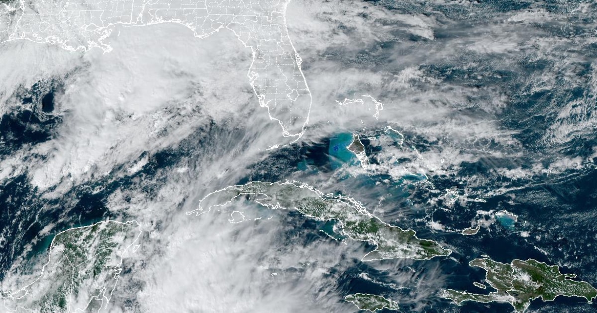

On Tuesday afternoon, seven million people along the east coast of Florida were under a Flood Watch head of heavy rain expected to fall Wednesday into Thursday.
The Flood Watch extended from Cape Canaveral down to Miami, including the urban areas of Melbourne, West Palm Beach and Fort Lauderdale.
Beginning Tuesday morning, major forecast models started signaling the potential for a narrow axis of heavy rain which could produce six inches or more of rain somewhere in the urban I-95 corridor and more specifically somewhere from West Palm Beach to Miami.
The first ingredient in the recipe for a potential significant rain event will be an area of converging air known as an inverted trough approaching South Florida from the Bahamas. Inverted troughs serve as a trigger point for showers and thunderstorms.
Where the heaviest rainfall occurs will be difficult to predict and it will depend on where a slow-moving frontal boundary lifting north from the Keys may set up over the area. This boundary, especially if it stalls, will concentrate an area of slow-moving thunderstorms that could train over the same area for hours at a time, sparking flash flooding.
The timing of heaviest rain, storms and onshore winds coinciding with high tide could exacerbate flooding issues.
Florida meteorologists were also sounding the alarm Tuesday morning that set-ups like this are historically favorable for significant rainfall events that can cause high rainfall rates (1-2 inches per hour) and high amounts of rain (6 inches or more) in just a few hours.
As of Tuesday afternoon, the major forecast models were still showing some consistency in the potential for a highly localized area somewhere between West Palm Beach and Miami to pick up 6 to 12 inches of rain by Thursday afternoon.
Meteorologists stressed it is impossible to predict the exact location that could see these highest rainfall totals, but if the ingredients come together just right the rainfall rates could inundate infrastructure and create life-threatening travel conditions if the rain causes flooded roadways.
This part of Florida does not need the rain, with the eastern half of Florida free of drought.
Fort Lauderdale is no stranger to extreme rainfall events, including a recent event this year. On April 12, the official reporting station at the airport picked up 22.5 inches of rain in one day. Other locations in the area picked up as much as 25 inches. This shattered the previous record for the wettest calendar day, which was 14.59 inches, set on April 25, 1979.
That event is also why Fort Lauderdale is currently having its wettest year on record, with 98.25 inches of rain so far in 2023. This is 41.91 inches above average to date.
Source: | This article originally belongs to Nbcnews.com