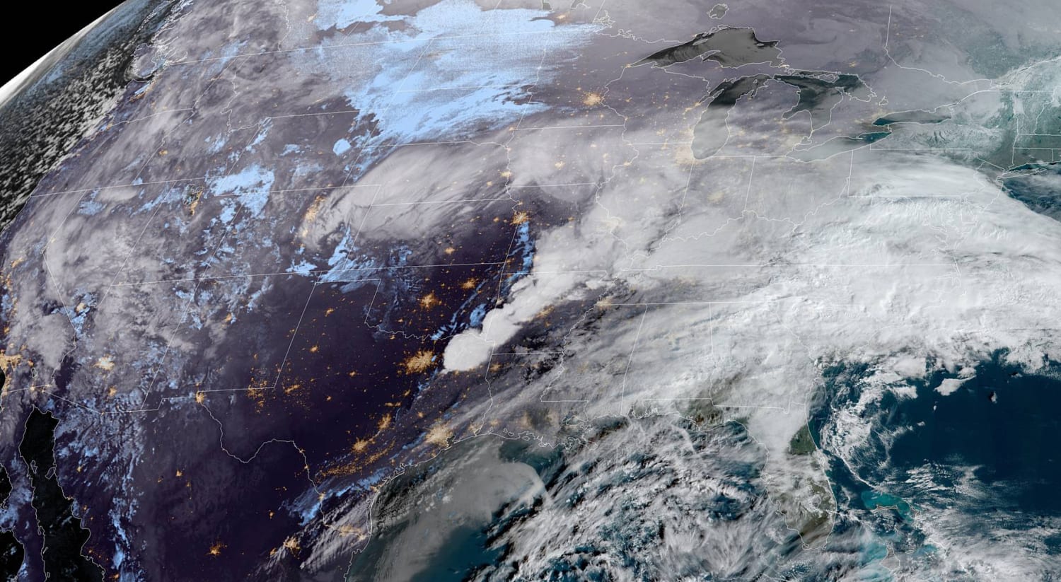
The country is expected to be hit with a slew of storms this week with winter weather alerts in affect Monday for 60 million people across 23 states, stretching from Southern California to the Midwest and mid-Atlantic.
Heavy snow was expected to fall Monday from the Central Plains to the Midwest and Great Lakes where cities like Omaha, Nebraska; Des Moines, Iowa; and especially Chicago could see their biggest snowstorm of the season.
Snowfall rates, forecast to be 2 inches per hour at times, will likely cause treacherous travel conditions and the risk of power outages.
For the Chicago area, heavy snow occurring around Monday evening’s rush hour could also be met with lakeshore flooding from Lake Michigan. Strong winds across the Great Lakes are expected to kick up large waves and cause flooding. For Lake Michigan, forecasts called for waves of 10-13 feet, producing a risk for water splashing up on Lake Shore Drive as well as inundating nearby parks and parking lots.
On the southern side of the system, strong storms capable of damaging winds and isolated tornadoes were forecast for the Tennessee Valley, including Memphis and Nashville, through Monday evening.
A wintry mix will also move into portions of the mid-Atlantic on Monday afternoon lasting into Tuesday morning.
On Tuesday, snow will move from the Great Lakes into the Northeast while showers and storms linger across the Southeast.
While the forecast is calling for mostly all snow in the Great Lakes and Midwest regions, it is a trickier forecast for the mid-Atlantic and Northeast. By the time the storm moves east it will encounter some warm air, producing a myriad of precipitation, from rain, to freezing rain, to sleet and snow. This wintry mix will mean lower snow totals and more likely slushy conditions.
Rainfall of 1-3 inches will fall along the path of the storm, along with 6-12 inches of snow across parts of the Plains, Midwest and northern New England.
For Chicago, 5-10 inches of snow has been forecast, with higher amounts possible. East Coast cities like Washington and New York could see up to 2 inches of slush.
As this first storm exits on Tuesday, another storm system will form along the Gulf Coast on Wednesday and potentially move up the coast. There is high uncertainty with this system but it could bring another round of rain, snow and wintry mix to portions of the Southeast and mid-Atlantic by Thursday.
In addition, the West Coast also remains in a very active pattern with constant rounds of Pacific storms.
At least three more storms this week will bring more heavy rain and snow from the Pacific Northwest to California, east into the desert, Southwest and the Four Corners region.
Up to 3 inches of rain is forecast along coastal areas, with locally higher amounts possible.
Up to 30 inches of snow is possible across parts of the Sierra and Arizona mountains, which will bring welcome relief to the drought-stricken region.
Source: | This article originally belongs to Nbcnews.com