
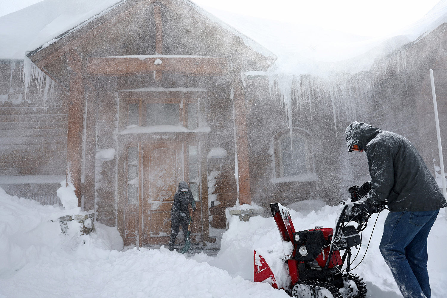
After a powerful blizzard dumped more than 7 feet of snow in parts of the Sierra Nevada, another storm will take aim at the Northern Sierra this week.
Winter storm warnings are now in effect for the Northern Sierra through Wednesday morning, with 12 to 24 inches of snow forecast.
This storm will stay confined to southern Oregon and Northern California from Monday into Tuesday, before bringing rain to Southern California on Wednesday.
The Sierras were battered with a blizzard from late last week into the weekend and clocked top snowfall totals of 87 inches in Donner Peak, 84 inches in Soda Springs, 73 inches in Kingvale and 61 inches in Twin Bridges, all in California.
Wind gusts as high as 180 to 190 mph were recorded at the highest peaks of the Sierras.
The new winter storm warning forecasts snow above elevations of 4,000 to 5,000 feet, with 2 feet at highest peaks. Wind gusts of up to 45 mph are also possible Monday. As a result, there will be reduced visibility, travel delays and road closures, and travel is “highly discouraged,” the National Weather Service said.
Elsewhere in the United States, eastern New Mexico and west Texas will be at risk for more wildfires Monday due to strong westerly winds gusting 25 to 30 mph and low humidity ripe for wildfire ignition and spread. Temperatures will cool off over the next few days and winds are forecast to subside, which should help with firefighting efforts.
Monday will also bring possible record March warmth.
About two dozen record highs are possible Monday from the Mississippi Valley to the Great Lakes and the interior Northeast. Highs from central Missouri to western New York are forecast to be 15 to 35 degrees warmer, leading to highs in the 60s and 70s.
Cities that could see record highs include St. Louis, Chicago, Detroit, and Syracuse, New York.
New York’s Buffalo Airport already reached a new daily record high of 64 degrees Fahrenheit on Monday, beating the prior record of 63 F set March 4, 1974. Theweather service office in Buffalo warned that the temperature will “likely climb” today.
Temperatures will cool off closer to more seasonal levels through the week.
Source: | This article originally belongs to Nbcnews.com