
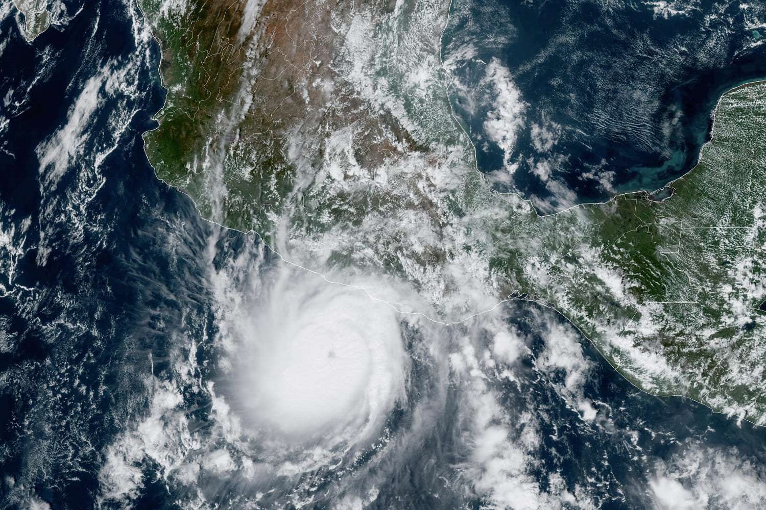
In a single day, Hurricane Otis went from a nuisance to a monster.
The hurricane, which made landfall near Acapulco on Wednesday morning as a Category 5 hurricane, “explosively intensified” by about 110 mph in just 24 hours, according to the National Hurricane Center, which called this a “nightmare scenario” for southern Mexico.
Only one other storm in recorded history — 2015’s Hurricane Patricia — has eclipsed that mark, it said in a forecast Tuesday night.
“Imagine starting your day expecting a stiff breeze and some rain, and overnight you get catastrophic 165 mph winds,” Brian McNoldy, a senior research associate at the University of Miami Rosenstiel School of Marine, Atmospheric and Earth Science, wrote on X. “Just 24 hours prior, it was a tropical storm and was forecast to make landfall as a tropical storm.”
The hurricane’s incredible ramp-up fits with a pattern scientists are following with concern. In recent years, a larger percentage of tropical storms have rapidly intensified as they approached landfall, meaning they gained at least 35 mph wind speed in 24 hours. The intensification is fueled by warm waters on the ocean’s surface, which provide extra energy for the storm.
Scientists are still puzzled over the factors that lead to rapid intensification. Climate change’s warming of ocean waters could be playing a role. Improvements in satellite technology have also increased scientists’ ability to track storms, which could make it easier to identify the trend.
A study published last week in the journal Scientific Reports found that tropical cyclones in the Atlantic Ocean were up about 29% more likely to undergo rapid intensification from 2001 to 2020, compared to 1971-1990. In recent times, more than twice as many hurricanes went from a Category 1 or weaker to a Category 3 or stronger in 36 hours, the study found.
Rapid intensification makes forecasting more challenging.
“Predicting rapid intensification remains one of the hardest problems in hurricane forecasting,” Robert Rohde, a climate scientist at the University of California, Berkeley, wrote on X. “This is a catastrophic miss.”
The hurricane center was forecasting life-threatening storm surge along the coast of southern Mexico on Wednesday. It expected destructive winds and heavy precipitation to continue further inland, producing mudslides and flash floods.
Kathryn Prociv contributed.
Source: | This article originally belongs to Nbcnews.com