
AN ANCIENT stone artefact has been hailed as a 4,000-year-old “treasure map” by archaeologists, rewriting what was previously understood of the slab.
The rock was previously established as an early 3D map of a Bronze Age territory in Saint-Belec, France, by separate researchers in 2021.

3

3

3
Researchers have been working on deciphering the etchings ever since.
The so-called Saint-Belec slab is now being used by archaeologists to hunt for ancient monument sites around north-western France.
“Using the map to try to find archaeological sites is a great approach. We never work like that,” said Yvan Pailler, a professor at the University of Western Brittany (UBO).
“It’s a treasure map.”
READ MORE ON WEIRD SCIENCE
The team are just beginning their search for long-lost monuments.
The Saint-Belec slab map covers an area about 30 by 21 kilometres.
According to Pailler’s colleague, Clement Nicolas from the CNRS research institute, this hunt could take as long as 15 years.
Ancient sites are more commonly uncovered by sophisticated radar equipment, aerial photography or by accident – and not, typically, by ancient stone maps.
Most read in Tech
The slab has stumped archaeologists for centuries.
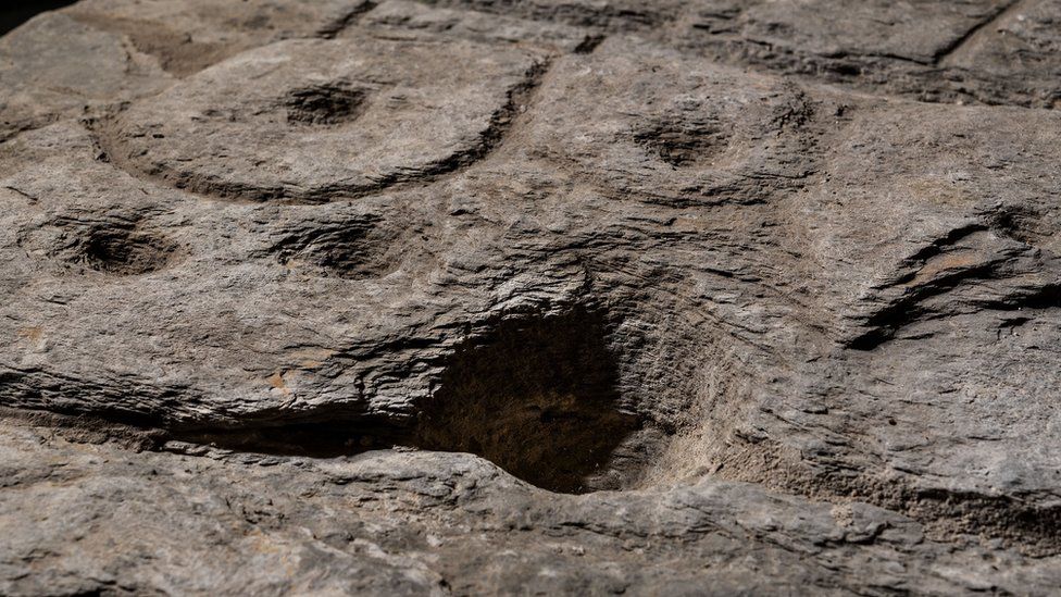
In 1901, French prehistorian wrote in the Archaeological Bulletin of Finistère: “To describe this curious monument with its cupules, its circles and its various engraved figures… is a difficult thing.
“Let us not let ourselves be led astray by fantasy, leaving it to a Champollion, who will perhaps one day find himself, to give us the reading.”
According to Pailler, a few of the engraved symbols in the rock “made sense right away”.
These included coarse bumps and lines which archaeologists recognised to be the rivers and mountains of Roudouallec, part of the Brittany region.
Comparing the slab with modern day maps, archaeologists found a roughly 80 per cent match.
Researchers believe the tiny hollow holes in the slab could point to burial mounds, dwellings or geological deposits.
“We still have to identify all the geometric symbols, the legend that goes with them,” said Nicolas.
Best Phone and Gadget tips and hacks

Looking for tips and hacks for your phone? Want to find those secret features within social media apps? We have you covered…