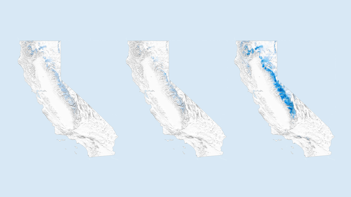

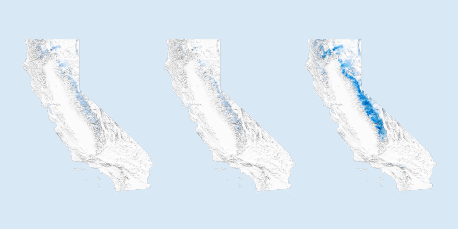

In the southern Sierra, the state has more than three times its typical snowpack – a record amount. Over the past several weeks, dam operators on snowpack-fed rivers have been releasing water to make more space to take on more water later in the season for flood control.
The pace and timing of the snowpack’s melt will be determined by the angle of the sun and the air temperature. Swain and other experts think the melt out will begin to speed this week.
Flooding in some parts of California – like the Sacramento River system – is driven by intense rainfall, usually in the winter months. These areas will likely avoid more trouble this season.
Instead, flood worries are centered on the San Joaquin River system, the Tulare Lake Basin and some parts of the Eastern Sierra, which don’t have as much capacity to control flooding and are fed by the outsize, high-alpine snowpack in the central and southern Sierra.
“In the southern Sierra, where we have the deepest snowpack, at some points we have about 5-6 feet of water sitting in the snowpack,” said Safeeq Khan, an assistant adjunct professor of civil and environmental engineering at the University of California, Merced. “Imagine 5 feet of water coming down within five or six weeks – how do you go about managing that water?”
More than 76,000 acres are underwater already in the Tulare Lake Basin, according to estimates from the California State Department of Water Resources. Dams on the four rivers that historically dead end at the lake will help control flows as snow melts. But, scientists expect the lake – which was dried out for use as farmland decades ago – to grow in size.
“They just can’t store all the water,” said Alan Haynes, the hydrologist-in-charge at the California Nevada River Forecast Center. “They’ve got to release it. It’s got nowhere else to go, except Tulare.”
Rural communities in the San Joaquin River valley could see flooding, too, if protective levees fail. The network of levees that’s designed to channel water away from homes and provide irrigation access is in poor condition, Haynes said. Breaches are possible and the levees will need persistent maintenance.
“It’s going to be a constant battle,” Haynes said. “It could impact homes and things, but we just don’t know exactly where.”
In Yosemite National Park – where the Merced River flows through alpine terrain – officials plan on Friday to temporarily close access to much of Yosemite Valley, the touchpoint for most park visitors. Park officials expect the river, which is unmanaged within the park’s boundaries, to exceed flood stage. High water could put visitors at risk.
“If we don’t have bathrooms, running water, roads – it’s health, life and safety,” said Scott Gediman, a park spokesman, outlining potential impacts and reasons for closure.
Californians throughout the Central Valley are keeping close watch on river gauge and dam outflow data.
In Kings County, where water managers have told residents to protect their homes and make plans for what to do if the Kings River overtops its banks, Caetano said he already has his 53-foot van trailer loaded with belongings and ready to take off.
“We know that mathematically it does not look good. Now the rest of it is going to depend on mother nature,” Caetano said.
Source: | This article originally belongs to Nbcnews.com